Friday, December 30, 2011

Scenic Highways

When I left Coral Pink Sand Dunes State Park on the morning of May 12th it was downright cold. I stopped at a roadside rest area on US 89 about 40 miles north (and somewhat higher in elevation) and saw a few trees and plants with tiny icicles hanging off of them!


About 11 am I arrived at the visitor center at Bryce Canyon National Park. There were campsites available, but the temperature was a “brisk” 35º and I opted to continue on my way, knowing that I could return later. I also wanted to stop at Kodachrome Basin State Park, which was nearby, but not when it was so cold.

Utah Route 12, which is the highway that passes by Bryce Canyon and goes north towards Capitol Reef National Park, is a Scenic Byway. And it is quite beautiful. The little bit that I saw of it anyway. It started out rather nicely. But the sky was strange looking. The clouds were blue!

The canyons near Escalante, looking westward. The midway point between Bryce Canyon and Capitol Reef parks.

Another view of the canyons, taken 10 minutes later, looking west.

The canyons near Escalante, looking to the north. Uh, oh.

I drove into the clouds and saw no more pretty views for the next hour. It snowed. Quite heavily in some places, but the roads were clear. It snowed all the way through the Boulder Mountains.

Near the summit (9600 feet high) of Boulder Mountain the sky started to clear. Steam was rising from the road surface. It felt quite warm when I stepped out of the van to take the picture. But alas, it was just a temporary clearing. It snowed, and sleeted, and slushed most of the way to Torrey, the turnoff to Capitol Reef.

Once again, I stopped at the visitor center. The campground was full. There was BLM land nearby where I could spend the night if I wished. But it was early afternoon, the weather was lousy and more of the same was predicted for the next day. I opted to continue on my way, knowing that I could return later. At least I glimpsed portions of the scenery as the highway meandered through the park.

A check of the map showed that Goblin Valley State Park was an hours drive to the north on Utah Route 24 so I set my sights on spending the night there, which is what I did.

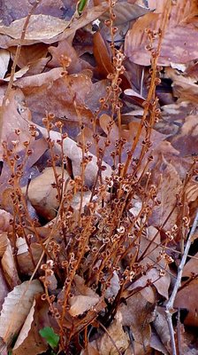
Shortly after I arrived at Goblin Valley, hail fell. Then it thundered and rained. Along about sunset time I glanced out the window and saw the tail end of a rainbow! Ah, Mother Nature in all her glory!

Yes, the photo is slightly out of focus, but it was such an unexpected and glorious sight that lasted only a few moments. It was there. Then it was gone.

You may think that I “complain” a lot about the weather. It's cold. It's hot. The rain. The snow. But I also frequently mention the beautiful blue skies and sunshine. Mother Nature can be fickle and even cruel at times, but you can be assured of just one thing – she is constantly changing. When you are living “on the road” the conditions “outside” are everything, you become more aware of them. The conditions affect your mood. They affect what you do and when you do it. So, yeah, I talk a lot about the weather. It's all I can do. Can't change it, though sometimes I wish I could.

Wednesday, December 28, 2011

It's Been a Week...

A busy week at that and I'm way behind with the blogging. Readjusting to cooler weather and dealing with the rain and the wind and the storms that have been affecting Northern Indiana as well as many other areas of the country. Aaahh Springtime!


My goal of not traveling on the Interstates from Louisiana to Indiana was successful. And I only had to travel on four-lane highways around and through towns and cities. Of course, it took a bit longer but it was worth the extra time and far less stressful.


It was rather startling to go from this (on the Natchez Trace April 19th):


To this (Northern Indiana on April 24th) where the only “green” is the grass:


But, thankfully, all of those April Showers have brought forth the beautiful flowers!


As I mentioned in an earlier post, I had a visit with the doctor earlier this week and I'm happy to report that my leg is feeling much better! An ultrasound was done to rule out blood clots and none were found. The doctor prescribed a pain-reliever/anti-inflamatory drug that has helped considerably. The cause of the pain? Most likely a pulled muscle that will heal itself with time.


I've been taking advantage of the “free wifi” here at my friend's house and working on several projects. Rather got “caught up” in researching a very, very distant relative who just happened to have lived in southern Noble County, not far from my ancestors here in Whitley County. And by “distant relative” I mean really distant. You have to go back to the 1635 immigrant, Thomas Joslin, to get to our common ancestor. It's been fun. Haven't had a challenge like that in quite a while!


What's ahead? I'm working on it, formulating a plan. Really. I had hoped to be able to attend the Southern California Genealogy Jamboree in June but that won't happen this year. I have to be back in Indiana by June 14th for a follow-up appointment with the doctor. But I've put the Jamboree on my calendar for .. along with RootsTech!


Enchantments Traverse

After a weather delay, we were finally able to do the Enchantments Traverse. We spent the day up in mountain goat country. That area is full of snowfields, steams, awesome lakes, granite boulders, slabs and peaks. With our side trip to Little Annapurna, it ended up being an 18 mile hike. The blisters should heal up in about a week :)


At about 2 hours into the hike, we arrived at Colchuck Lake.


A couple of hours later, we made it to the upper basin and started seeing mountain goats.


Then we ran into a few well-camouflaged Rock Ptarmigans.


We couldn't resist standing on the collapsed snow cave.


Ron and Doug ontop of 8,440' Little Annapurna. Mt. Stuart and Dragontail Peak in the background.


Prusik Peak, Mount Temple and several of the alpine lakes.


Little Annapurna as seen from Perfection Lake.


Some people say that this is the most beautiful place in Washington State. We've been to some amazing places. I can think of several that are close, but none better!


Tuesday, December 27, 2011

Beechdrops

On our walk the other day, hubby and I were looking for something specific (Puttyroot leaves - more on that later). We didn't find any. But this was just as exciting.


I'm fairly certain that these were Beechdrops (Epifagus virginiana), a plant that's parasitic on the roots of Beech trees.

I've never seen them before, even though many references call them "common". They probably bloomed in October, but from the photos I've seen, they look about the same whether they're blooming or not. (No chlorophyll.)


OK, I guess you have to be a total wildflower geek to think that this is exciting. But I am, so I do!

Interesting write-up with historical references here.

Saturday, December 24, 2011

Bull Snake

With all the moving of dirt with the tractor a snake was discovered wondering around wondering what was happening to his home. We assumed he or she was a bull snake as it didn't have any rattles on it's tail but it could have been some other kind of snake as I am not very versed on snake species. Anyway we encouraged it to slitter up in under a wild four-a-clock clump and it has not been seen since. I don't bother them if they as they eat lots of mice and rats of which we have enough for several snakes like this one.


Tuesday, December 20, 2011

Mount St Helens :: 30 Years Later

At 8:32 am on May 18th, 1980 a magnitude 5.1 earthquake “shook the ground beneath Mount St. Helens in Washington state, setting off one of the largest landslides in recorded history - the entire north slope of the volcano slid away. As the land moved, it exposed the superheated core of the volcano setting off gigantic explosions and eruptions of steam, ash and rock debris. The blast was heard hundreds of miles away, the pressure wave flattened entire forests, the heat melted glaciers and set off destructive mudflows, and 57 people lost their lives. The erupting ash column shot up 80,000 feet into the atmosphere for over 10 hours, depositing ash across Eastern Washington and 10 other states.” - - from The Big Picture which has a fantastic collection of photos of the volcano and its 1980 eruption.

The western side of Mount Saint Helens as seen from the Visitor Center at Silver Lake, 46 road-miles away.

From a viewpoint on the north-northwest side.
Clouds covered the upper half of the volcano for the entire afternoon with an occasional break, which briefly revealed the peaks. This, and the remaining photos were taken from the Johnston Ridge Observatory. Named for David A. Johnston, a volcanologist on duty nearby on that fateful day. His last words were “Vancouver, this is it!”

The lateral blast exploded to the north toward what is now Johnston Ridge and, quite literally, destroyed everything in its path.

The mountains and valleys were tall old-growth forest. Now all that remains are a few denuded logs lying about like pick-up-sticks.

A park service sign nearby tells a tale of the blast as “spoken” by this stump: “Step up and look at me carefully. Notice my shattered trunk, my missing top. I once stood 150 feet tall, surrounded by a beautiful forest of green and growing trees. When the blast exploded sideways out of the mountain, it plowed through the debris avalanche and swept across the landscape, picking up and carrying large chunks of rock, ice, and splintered wood.”

“Within a minute, I was struck and scoured by the stone-filled wind. My bark and branches were stripped and scattered toward the edge of the blast zone, 17 miles away. As trees that had stood for hundreds of years crashed around me, my upper trunk strained, then shattered in the nearly 700 mph winds. Only a small part of me remains as evidence of the blast's power.”

Down in the valley, the blast dumped 680 feet of debris, filling Spirit Lake to the east with logs and ash.

Johnston Ridge was completely denuded. Spirit Lake lies beneath the far ridge at left-center and St. Helens rises up from the valley on the right.

The early evening light emphasizes the ridges and the gulleys now being carved out by the flow of water.

Another view of cloud shrouded St. Helens from Johnston Ridge in the early evening. All photos were taken on Sunday, September 12th.

The Johnston Ridge Observatory, which is 5 ½ miles from the crater, has some really nice exhibits as well as a 16-minute movie about St. Helens. If you've never been there, it is well worth the 60-mile drive off of Interstate 5 on State Road 504.

A couple of the many websites about Mount St. Helens:
  • The many faces of Mt. St. Helens
  • Mount St. Helens Visitor Guide
  • Mount St. Helens National Volcanic Monument

Monday, December 19, 2011

Finally some real ice in South western Pennsylvania


The south western Pennsylvania woods are finally looking like winter


Laura and I decided to take our chances and head into Sunday School Crag to try and climb one of the new lines I found last week. It was a warmish 29° when we left the house and made our way up to the parking area. Upon arrival it was 23° which made me feel more optimistic that the line would have held over the warmer days this past week.


Parking area for Sunday School Crag
During our hike in to the climbs we were breaking through the crust that the recent ice storm left in its wake. I knew this recent ice crusting might be of some concern on the lines we were going to try and attempt. Sunday School Crag is the most alpine like crags of south western PA.


Coming out of the woods and into the crag
The temps are always colder, the wind is always howling and is usually downright uncomfortable. The ice lines are a lot more committing than most other local crags, with traditional gear being involved in most ascents. Most lines I've climbed here commonly involve some sort of barely held together limestone choss with varying thicknesses of verglas beteween sections of ice pillars and runnels. In other words some seriously fun climbing that might make you stain your drawers and then smile about it after its done.

On the way in we scoped out some of the lines. Here's a couple we want to try in the near future.


Laura below one of several unclimbed lines we eyed


One of the top options for the day!


Not sure if I should be excited or terrified for this one.

Either way its an incredible looking mixed climb that I want to try.


After checking all the other options, we headed to the long alpine looking corner route I found last week. I was really hoping it was in. I had thought about it all week and couldn't wait to get on it. We rounded the corner and it came into view and was looking at least as good as it did last week. I was afraid that the water might have started to wash it out from behind. The temperatures must have been quite a bit colder here that at our house. The climb had very little water running off of it and looked as if it were good to go. The climbs to the right were running hard with water and were dropping some rather large chunks of ice.


Standing near the bottom of our chosen climb


The climbs to right on this wall were running hard and dropping ice


We didn't waste much time. I've never been on this line and had seen it for the first time last week. I looked it over and scoped out a potential line and racked up accordingly. Going ground up is always a little more exciting and I find over-racking is better than under. The line looked a little boney so it was mostly 13cm screws. I also racked some quick draws, a few runners, screamers, a half rack of nuts, and 3 cams. Plus belay coat and gloves, belay device, thread tool, cordage, spare biners, a 22cm screw for a thread if necessary/possible. I recently received a set of the new Petzl dry T rated picks (which is a whole other post in itself). I'd been anxiously waiting to try them on an "ice" route. I resisted the temptation to take them dry tooling and dull the hell out of them over the past couple of weeks. Also new was a shiny pair of Grivel G4 crampons, complements of Rob "Griz" Ginieczki for helping with the second revision of Ice Climbing Pennsylvania (available for purchase soon). All this new gear to try and on a new line, How cool! I'd used the previous versions of the Rambo's over the years and always liked their rigid frame for pure ice. My last pair were hijacked by Laura (who likes them a lot as well) and I just hadn't replaced them when Griz surprised me with these. Thanks again Griz.


Racked and excited to get on some real ice!
The climb was well... Awesome! What a great first ice route of the season. It went well. The ice was mostly very thin. There were plenty "eyelids" on the bulges from the ice storm as expected. Lots of new ice and snow to be cleared as I ascended the runnels that flowed down the 200' cliff. Even with a "soft" swing attitude today I still managed to put falcons beaks on both of my new picks. They performed well and I can say that the new picks perform better on ice than the old Astro picks that I loved so much. Now that I've used them on an ice route I can go out and trash them at will. I have a few more sets coming my way. I'm definately NOT a fan of the new washer design that has now made changing picks in the field a big pain in the ass. Right up there with Grivel's three bolt system. The crampons were sweet as expected! Grivel has the rigid design and point configuration nailed. The extra weight seems to help drive them into the ice with much more authority than the Petzl Darts I've become used to.

We named the line Late Bloomer. We thought it a fitting name for our current season being the worst ice season in area history. Climbing this line today almost made me forget how unproductive local ice has been this season. I'm a little hesitant to grade the line. I'm sure it'll be much easier during a normal season of cold, producing plentiful ice. Today it felt like a commiting WI4+ in lean condition. Protection was a little sparse and I would not recommend this climb for the budding WI4 leader. What it lacked in vertical sections it made up for in sparse protection and lack of ice. Here's the photos of us on the climb.


Starting up the line it got thin early on


Short thin pillars with a few mixed moves, very alpine feeling


I'm in the middle of the photo, Giving scale to the climb


Just another day in the Pennsylvania alpine


Laura moving over a lower angle snow/ice slab


Even enough ice for a V thread rap!


Laura is all smiles on this one!

Late Bloomer WI4+

South Western Pennsylvania


Is there more? There's always more here in SWPA


The End!
So south western Pennsylvania ice season has officially begun for us. Who knows if February will contain colder temps and provide us with more lines to try this year. Hopefully it does. Keep checking back for all our PA climbing nonsense. With some luck we'll be able to send a few more of the new lines at this crag. I hope everyone got as lucky as we did this weekend! What a blast... cant wait to get back for more!